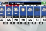
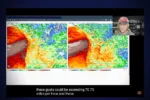
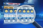
As February comes to a close, many of us are wondering what March will bring for the weather! Will we see snowflakes dancing in the air, or will spring surprise us with warmer days? This year, the weather has been quite unusual, feeling more like early April than late winter. While some are still dreaming of a winter wonderland, others are relieved to escape the freezing temperatures we faced just last week. Join us as we explore the curious weather patterns of this season and discover what to expect for March in Rochester!
| Category | Details |
|---|---|
| Overall Weather Trend | Temperatures are 15-20°F above normal for late winter, contrasting with last week’s Arctic blast. |
| Current Winter Conditions | Season has been cold but with less snowfall than average. |
| Snowfall Measurement | Rochester has received 12.7 inches of snow this season, 26.9 inches below normal. |
| Historical Context | Last winter (El Niño) was one of the warmest, with significantly more snowfall. |
| La Niña Impact | Typical for colder weather, but storm track has diverted most snowfall away from the area. |
| Predictions for March | Normal temperatures and slightly above-average precipitation expected. |
| Snowfall Expectations | To avoid being in the top ten least snowy winters, Rochester needs over 25 inches of snowfall. |
| Current Outlook | Chances for significant snowfall are diminishing; rain is more likely. |
Will March Bring Snow to Rochester?
As March approaches, many people in Rochester wonder whether they will finally see some snow. This winter has been quite different, with warmer temperatures and less snowfall than usual. So far this season, Rochester has only received 12.7 inches of snow, which is much lower than the average of 39.6 inches. The climate pattern this year has kept the storm systems away, leading to drier conditions and fewer snowflakes falling from the sky.
According to the Climate Prediction Center, normal temperatures are expected for March, but that doesn’t guarantee snow. In fact, it looks like we might have more rain than snow this month. For snow lovers, this is disappointing news. Instead of enjoying winter wonderland scenes, the weather might be more like early spring, with green grass and blooming flowers. Let’s hope for a surprise snowstorm to make winter feel a little more complete!
Understanding This Winter’s Weather Patterns
This winter has puzzled many weather watchers because of the unusual patterns we’ve experienced. The La Niña weather pattern usually brings colder temperatures and more snow, but this season has been different. Instead of snow storms, much of the moisture has stayed to the south, leaving Rochester with very little snow. This has made it the third least snowy winter on record, which is surprising for a season that typically brings plenty of winter weather.
The reason for this unusual weather is due to the position of the jet stream. When the jet stream dips south, it can steer storms away from our area. This means Rochester has had a colder winter but with fewer snow events. While some may be happy to see milder temperatures, others might be dreaming of snow days and snowball fights. Understanding these weather patterns helps us know what to expect as we move into March and beyond.
What to Expect for March Weather
In Rochester, March usually brings a mix of winter and spring weather. This month often sees some snowfall, but it can also bring warmer temperatures. Currently, the forecast suggests that we might not get the typical amount of snow we expect. Instead, we may see more rain, which could signal the start of spring. As we transition from winter to spring, it’s important to prepare for changing weather conditions.
The average snowfall for March in Rochester is about 8.6 inches. However, with the current trend of dry weather, it might be tough to reach this number. If we do manage to get more snow, it could help improve our rankings for snowfall this season. For now, it looks like we may have to wait and see what March has in store, hoping for a few more snowflakes before spring fully takes over!
Understanding La Niña’s Impact on Winter Weather Patterns
La Niña significantly influences weather patterns across the Northern Hemisphere, particularly in the Midwest. This phenomenon typically leads to colder temperatures and altered precipitation patterns. As we’ve observed this winter, the persistent La Niña conditions have resulted in a colder climate overall, yet with a surprising lack of snowfall. The shifting storm track has diverted most precipitation southward, leaving regions like Rochester experiencing drier conditions than expected.
Historically, winters with La Niña conditions can lead to extremes in temperature and snowfall. For instance, the winter of 2020-2021 showcased how a similar pattern affected snowfall distribution, resulting in significant snow in some areas while others remained dry. This season, we are seeing echoes of that pattern, where the Upper Mississippi Valley is experiencing less precipitation and a reliance on sporadic weather systems that fail to deliver significant snow.
March Weather Forecast: What Can We Expect?
As we approach March, the seasonal average suggests about 8.6 inches of snowfall for Rochester. However, current forecasts indicate that we may not meet this expectation, especially given the drier-than-normal trends observed throughout the winter. Early March looks to be predominantly dry, with temperatures hovering around seasonal averages. This shift from winter’s chill to a spring preview may come as a relief, but for snow enthusiasts, it raises concerns about the lack of snow.
Meteorological models are indicating a continuation of this trend, with normal temperatures and slightly above-average rainfall anticipated. This could mean that residents will see more rain than snow in the coming weeks, further diminishing hopes for a late winter snowfall. As we monitor changing weather patterns, it’s clear that March may not deliver the snow many are wishing for, making it essential to stay informed about upcoming forecasts.
Comparative Analysis: This Winter vs. Last Winter
When comparing this winter to last winter, it’s evident that we are experiencing a different climatic scenario. Last year was notably warmer due to El Niño conditions, resulting in minimal snowfall and milder temperatures. In contrast, this winter has brought colder temperatures due to La Niña; however, it has paradoxically led to less snowfall overall. The current season has recorded only 12.7 inches of snow so far, significantly below the average, highlighting the unusual character of this winter.
This comparative analysis reveals that while temperatures have fluctuated dramatically, the key takeaway is the lack of precipitation. The current season stands as one of the least snowy winters in recent history, with the potential to break records for low snowfall totals if trends continue. Understanding these patterns not only helps us anticipate weather changes but also prepares us for discussions about climate variability and its effects on local ecosystems.
The Future of Weather Trends: Predictions for Spring
Looking ahead, spring weather patterns are anticipated to remain inconsistent, influenced by ongoing La Niña conditions. The Climate Prediction Center suggests normal temperatures with slightly above-average precipitation, which might indicate a wetter spring than winter. This could result in a shift towards more rain than snow, making the transition into spring less traditional for regions accustomed to significant March snowfalls.
As we prepare for spring, it’s important to consider how these weather trends impact our local environment and daily life. Increased rainfall can lead to improved soil moisture levels, beneficial for agriculture, while also raising concerns about potential flooding in some areas. Keeping an eye on these evolving weather patterns will be crucial for residents as they navigate the transition from winter to spring.
Frequently Asked Questions
What is La Niña and how does it affect winter weather?
**La Niña** is a weather pattern that makes winters colder and potentially snowier. It can cause temperatures to drop and change where storms go, often keeping snow away from some areas like Rochester.
Why has this winter been so dry and warm compared to others?
This winter has been **drier and warmer** because the main storm track is further south. This means less snow for areas like Rochester, resulting in only 12.7 inches so far.
How much snowfall does Rochester usually get in March?
Rochester usually gets about **8.6 inches** of snow in March. This is important because it helps keep the winter season interesting for snow lovers!
What are wind chill values and why do they matter?
**Wind chill values** tell us how cold it feels outside when wind is added to the temperature. For example, if it’s 30°F with wind, it might feel much colder, making it important to dress warmly!
What does it mean to be below the normal snowfall average?
Being **below the normal snowfall average** means that Rochester has received less snow than expected for the season. This year, it’s 26.9 inches below normal, which is quite a bit!
What weather changes can we expect in March this year?
In March, Rochester is expected to have **normal temperatures** but slightly more rain than usual. This might mean less snow and more spring-like weather as the month goes on.
How does a southern dip in the polar jet stream affect snowfall?
A **southern dip** in the polar jet stream can push storm systems away from our area, which means we get less snow. This year, that dip has kept most of the snow south of Rochester.
Summary
The content discusses the unusual weather patterns in Rochester, Minnesota, as March approaches. It highlights a significant temperature shift from last week’s extreme cold to milder early spring conditions. Despite hopes for snowfall, this winter has been notably dry, with only 12.7 inches of snow recorded—26.9 inches below normal. The La Niña pattern is influencing the weather, causing most winter storms to track south. As March progresses, the Climate Prediction Center anticipates normal temperatures and slightly above-average rainfall, suggesting limited chances for significant snowfall, leaving snow enthusiasts with dwindling hopes.


